
We wanted to drive to the end of Highway 138 which took about 4-5 hours and then you head back on the same highway. We left our campsite at Longue-Pointe-de-Mingan and headed out. Hwy 138 is called the route to the End of the World or the Whale Route (Route des Belaines) or just The Route. It is a highway in the the stunning Côte-Nord region, offering wonderful views of the Saint Lawrence River. This highway is a lifeline that connects various communities and when you are at the end, if you want to continue to other communities, it’s by boat or ferry. The road was pretty good and ended in the village of Kegaska. When you reach the end, you either turn left or right to dead ends.
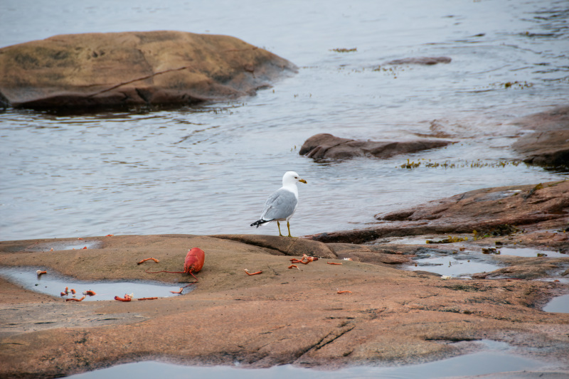
On the way there, because we’re nosey, we stopped at a free campground just outside Baie Johan Beetz which was right on the water and I mean, right on the water! It was a rocky shoreline and we couldn’t believe what the sites looked like. It would be okay if you had a camper van but for us, it would have been difficult to get there and set up. We did watch a seagull eating a lobster on the shoreline which was kind of cool. We drove through Aquanish (population 224), Natashquan (population 262), Nutashkuan(population 915) and of course Kegaska (population 124). Clint and I like to do off road adventuring so anytime we saw a dirt road, usually going nowhere, we headed down it. We did 526 kms that day but it was very enjoyable. Here are some photos to look at…….
Dinner 
After dinner drink 
A view of the campground, such as it is….. 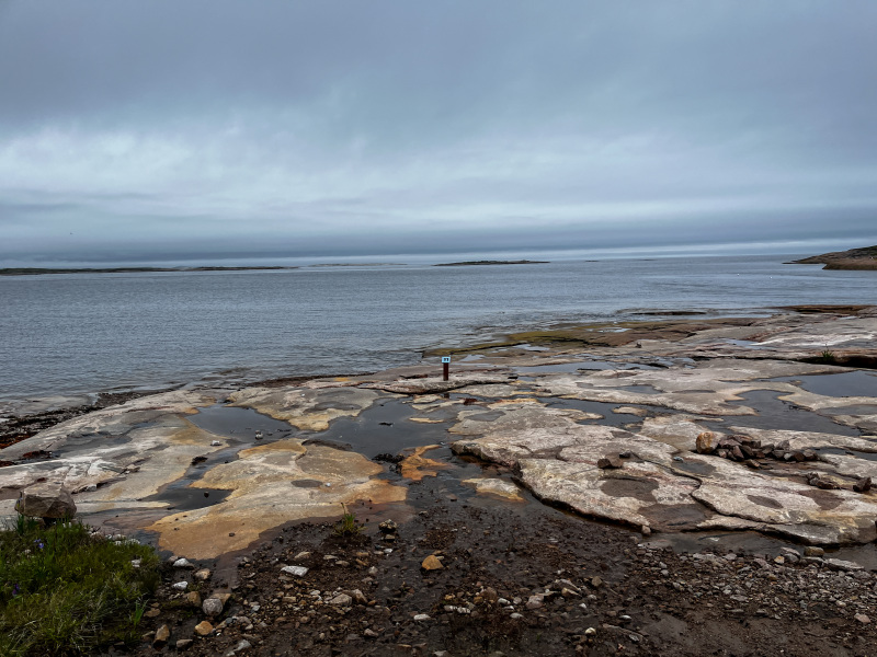
You can see a sign on the rocks, that was one of the campsites 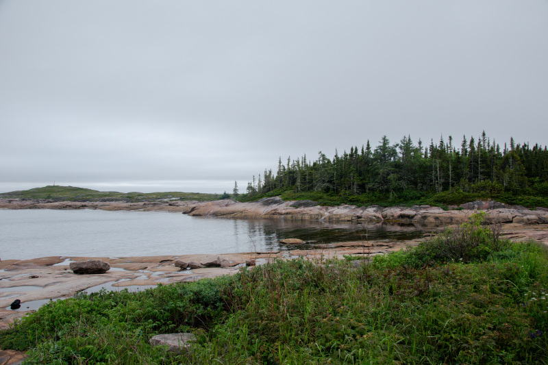
View from the campground 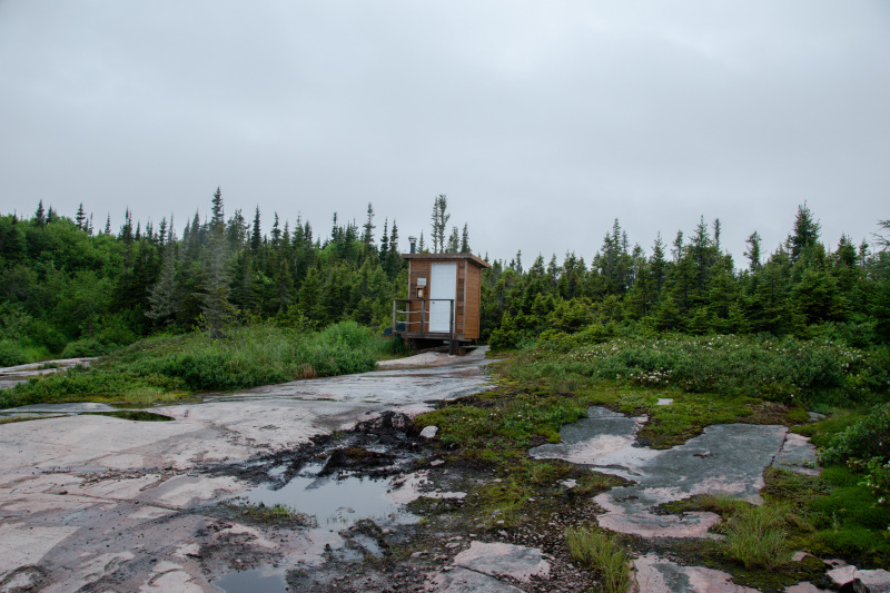
Campground Outhouse
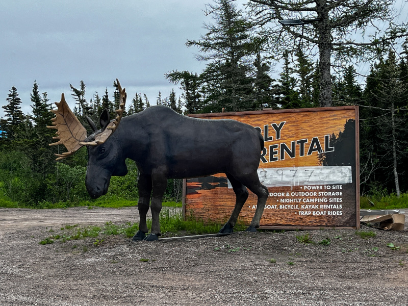
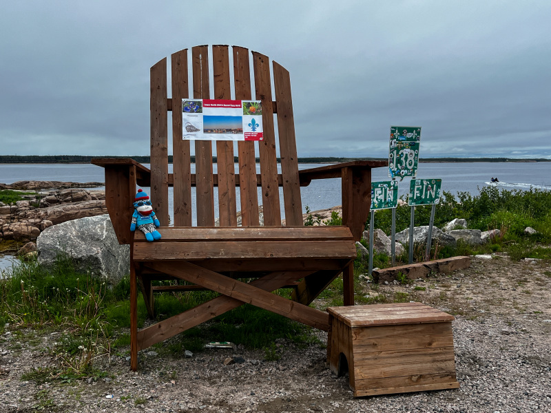
A sign at another campground we drove by 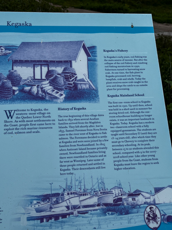
History of the town of Kegaska, population approximately 124 people 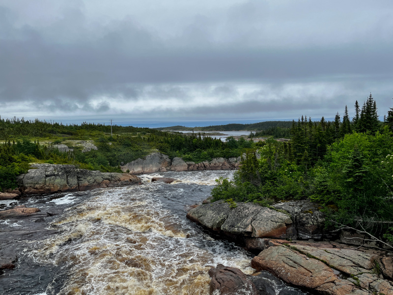
Beautiful scenery 
A cafe we stopped at in Natashquan 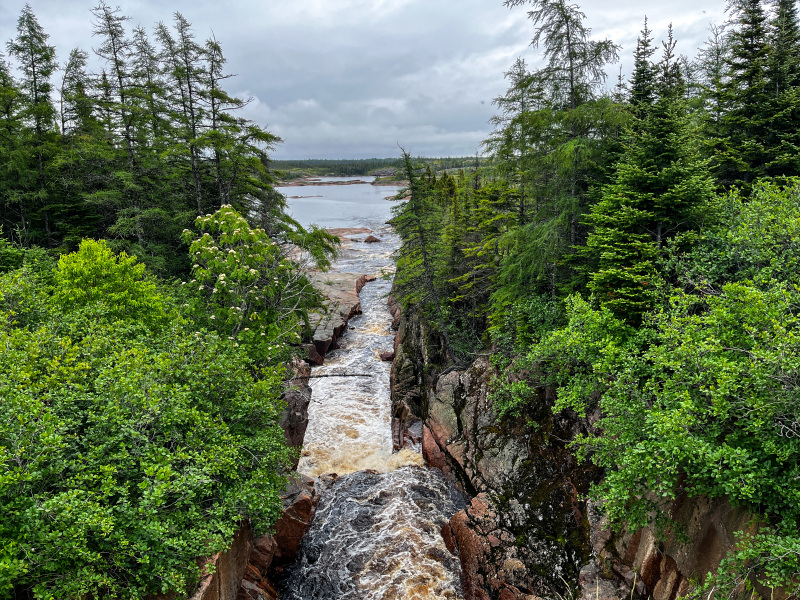
On the side of the road 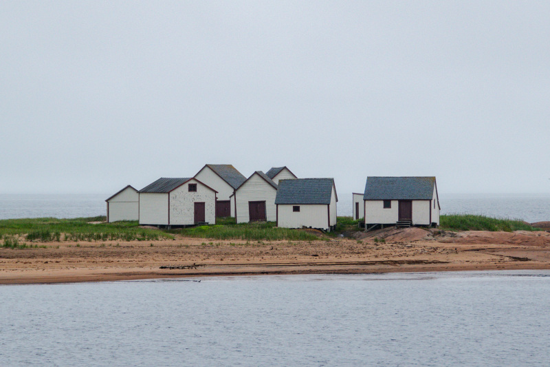
I liked these little houses 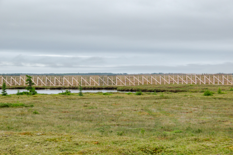
A snow fence, keeps the snow, most of it, from getting to the road 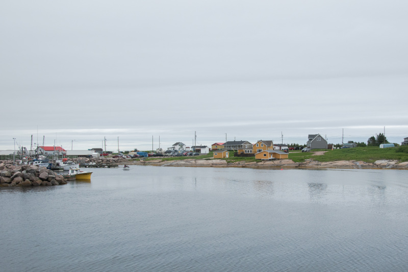
One of the towns on our way 
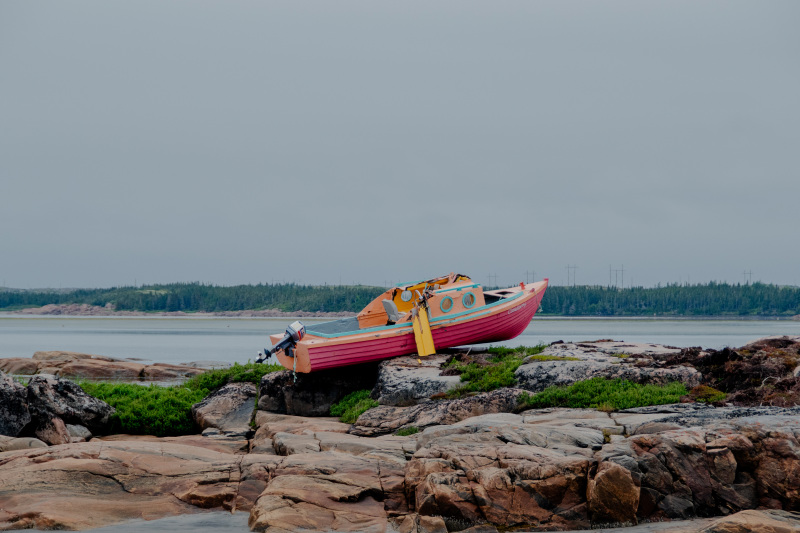
A boat on the rocks 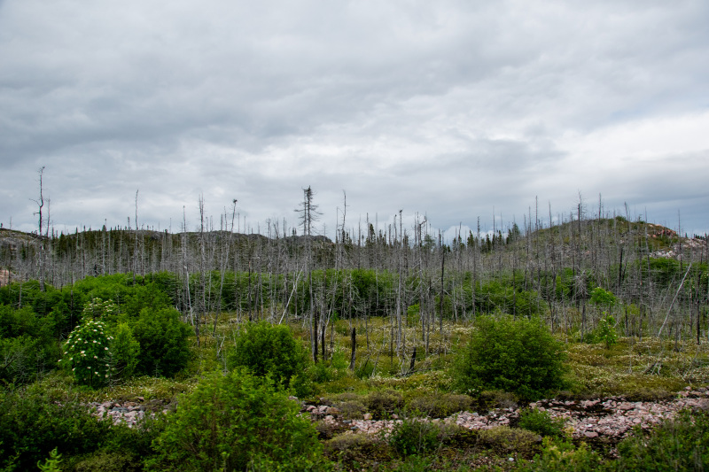
Some of the landscape 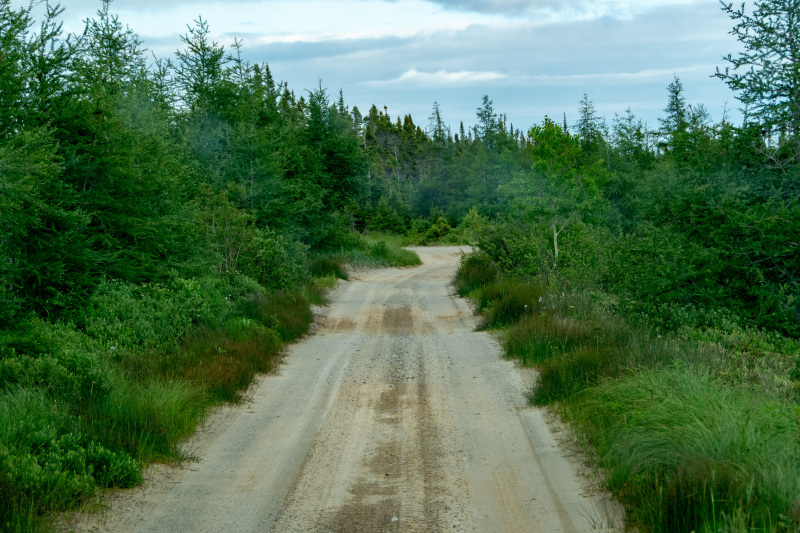
A dirt road to nowhere, very narrow and bumpy 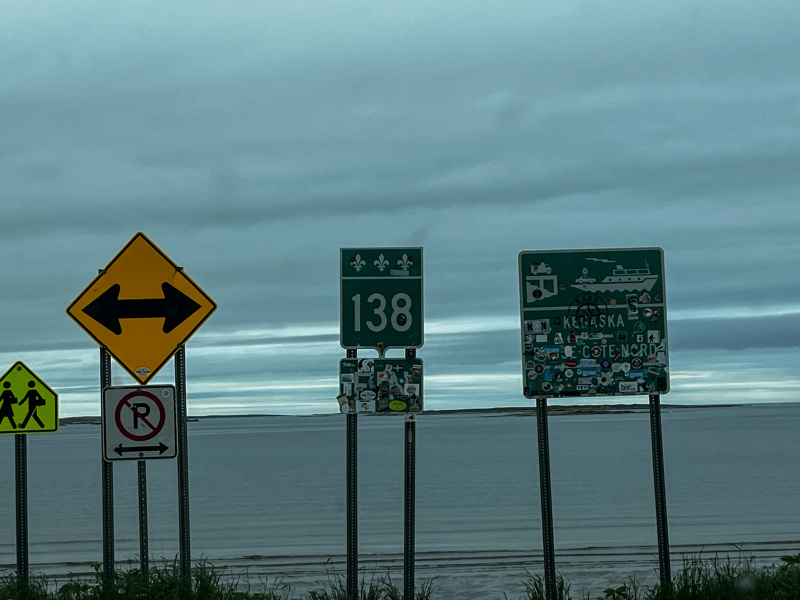
The end of the road….
Next stop Baie Comeau, home of one of our past Prime Ministers, Brian Mulroney.
See you soon !

Wow, the landscape up there is so beautiful! Raw beauty! Somehow it reminds me of Michigan’s Upper Peninsula. That campsite at maybe one foot above sea level on the rocks is one that I’d avoid!
LikeLiked by 1 person
Ha ha yes those campsites were something else. We were not going to camp there. I think the landscape is so beautiful up here because there are no people to ruin it lol
LikeLiked by 1 person
That’s the key, Susan, some people can destroy what is beautiful whether intentionally or not. The same thing happens here in the desert. I think it was two years ago that two very young men got themselves in VERY deep trouble for destroying some Native American rock art. That’s just inconceivable to me.
LikeLiked by 1 person
Oh no ! That is horrible. And it doesn’t matter if you put up signs, some people just don’t care if it says “stay on the trails” or whatever. It makes me sad and melancholy for when people were more considerate.
LikeLike
It’s totally disgusting. I remember a much kinder, better time in my country when folks had respect for each other and much more. 😭
LikeLike
Such beautiful views out there!
LikeLiked by 1 person
It sure is and there’s very low population of people so the scenery takes over instead of skyscraper and subdivisions. It is quite stunning along this area.
LikeLiked by 1 person
That is a cool dinner shot! The lobster may disagree, but nature does not always leave everyone (creature) satisfied. A wonderful collection from start to finish and I love the visual of this line: “When you reach the end, you either turn left or right to dead ends.” Definitely the end of the road! Thank you for sharing your traveling adventures with us. 🦞
LikeLiked by 1 person
Yes the circle of life ! You are welcome, I’m glad you enjoy hearing/seeing about our travels. I started your book today, it’s wonderful Michele. You are a gifted writer.
LikeLiked by 1 person
Very much so and thank you with all my heart, for your interest in my book and for affirming my writing journey. ✍🏻
LikeLiked by 1 person
I am halfway through your book, simply put…….it’s wonderful reading. It’s hard to put down. Your writing has such a great flow, you must be still so thrilled about writing this book. I think I would be on Cloud Nine for months!
LikeLiked by 1 person
I’m honored that you’re reading my book and most grateful that my writing is resonating with you. Thank you so much, Susan. I appreciate you taking the time to tell me – a cherished gift for me. 😊🌤️
LikeLike
This is very scenic along the way and I liked those little houses too. Even though you have to feel for the lobster being picked apart by the Seagull’s bill, that is a very cool shot. The big chair with the stepstool to get up and Mr. Trum – all very fun. I can’t imagine camping in any vehicle or tent in that area. Scenic yes, but wow, you might get washed away! I think it would be nice to live in a small town like that.
LikeLiked by 1 person
What a beautiful area! I bet there were a lot of animals in the area along that dirt road. I can’t imagine camping on the rocks, especially at that sign! We have never visited up north but hopefully someday!
LikeLiked by 1 person
That was a crazy campground for sure! I don’t know how many people they get camping there. We didn’t see too many animals at all. Maybe 3 moose total, a couple of whales from a distance and some seals !
LikeLike