

Well, a rainy day but we were heading out anyways as we had a reservation at Lake Superior Provincial Park at Rabbit Blanket Campground. The drive was about 5 1/2 hours but on the way there, we drove through Little White River Provincial park and the road ran parallel to a beautiful river. I spotted a deer and some Mergansers but it’s hard to stop when you are pulling a trailer on narrow roads. It was a really nice drive though. Lake Superior Park has two separate campgrounds; Rabbit Blanket (60 campsites) which is situated on Rabbit Lake and Agawa (147 campsites) which is located right on Lake Superior. They are about 35 minute drive from each other and we have stayed at each of them a couple of times. They also have tons of Interior campsites if you like difficult hikes and choppy waters! Oh if I were younger……..I would do the difficult hikes and choppy waters! I love the Lake Superior area, it’s landscape is beautiful, very rocky and hilly and it reminds me a bit of Newfoundland. A bit of information about Lake Superior: it is the largest of the five Great Lakes and also the largest fresh water lake in the world. Some interesting facts can be found at this link.
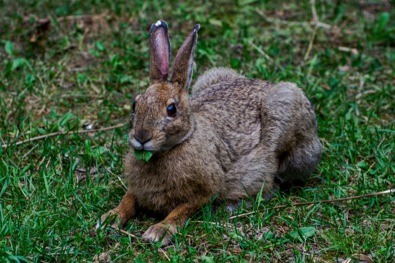
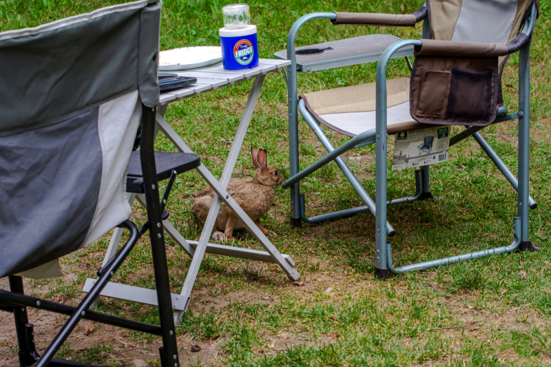
So we chose to stay at Rabbit Blanket Campground this trip and we had site 29, a really nice, level, large site with a “Rabbit Resident.” We named her Betty Bunny and she was hanging around all the time eating grass, not smoking it, just eating it. I was sitting outside for a bit and wondered where she was and I got up and walked around the back of our trailer to see if she was hanging out there. I came back to my chair and she was sitting under it! lol She was sweet.

There is a lot to do in this area, if you are an outdoorsy person. We checked out a number of places, some we have been to and some we haven’t. We drove to Mijinemungshing Lake which is the gateway to the interior of the Park, 40 kms of shoreline, beaches, campsites and wetlands. You can get to the Sand River by way of Old Woman Lake. Gamitagama Lake Road was another stop we made and you can also get to the Sand River or to Mijinemungshing Lake via Old Woman Lake..

Me enjoying the view of Mijinemungshing Lake 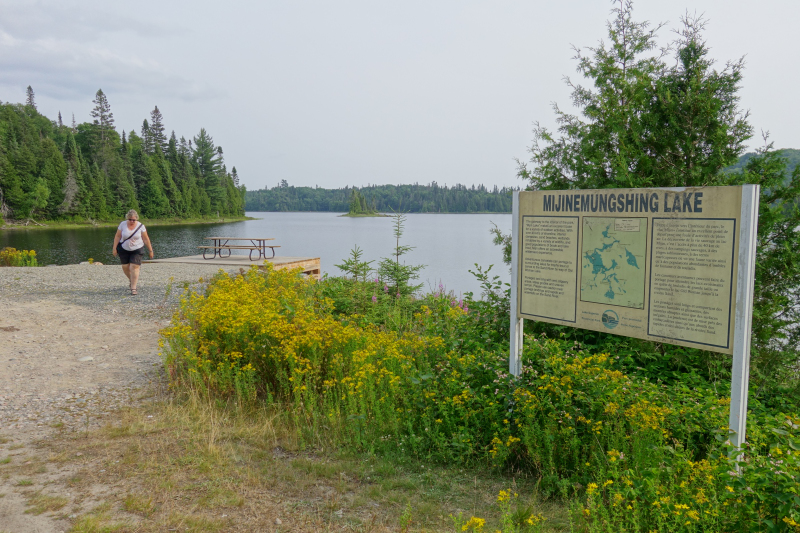
Gamitagama Lake Trail Head
We had more rain while here so one day we decided to drive to Wawa, maybe a 30 minute drive and also where you go to get gas! We stopped at an old General Store and also at the Big Goose at the Visitor Centre with Trum.
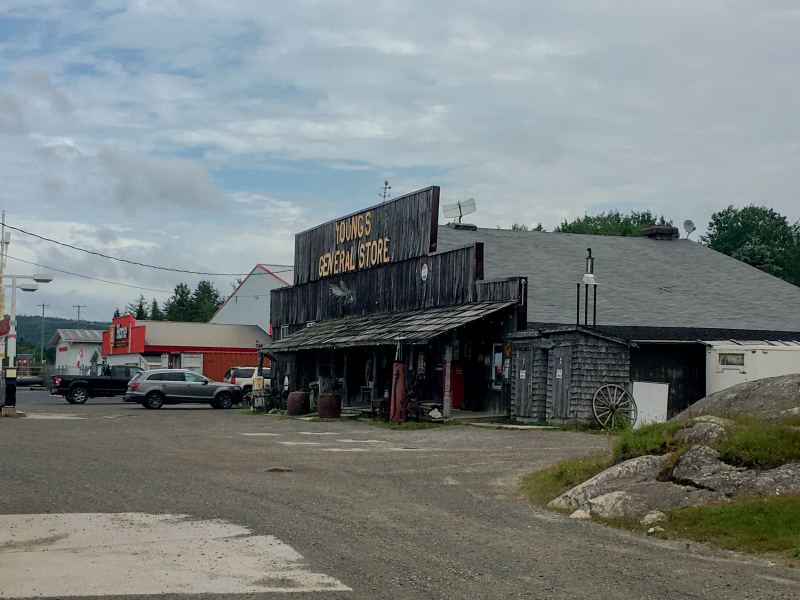
General Store 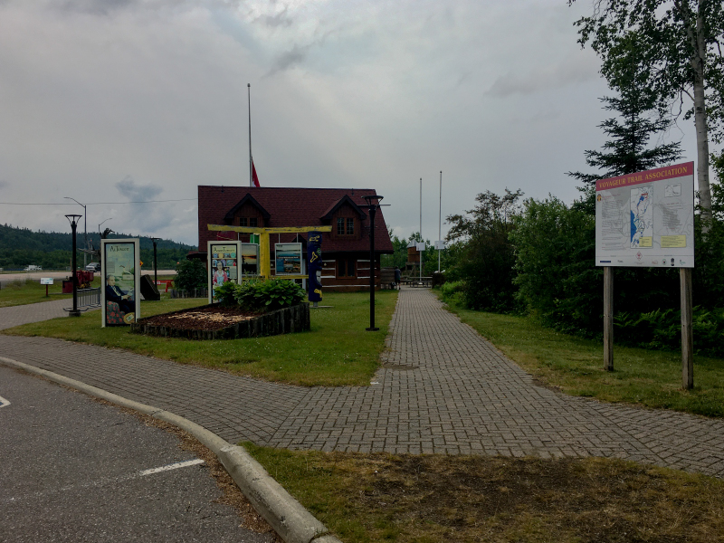
Visitor Centre and Big Goose Statue 
You can barely see Trum but he is sitting on the base of the Goose statue
This is also, approximately, the halfway point of the 7,281 kilometres Trans-Canada Highway. The Trans-Canada highway, constructed between 1949 and 1970, stretches from St. John’s, Newfoundland to Victoria, British Columbia.
On to High Falls, nice lookout and falls, we saw so many sandhill cranes on the way in and out.
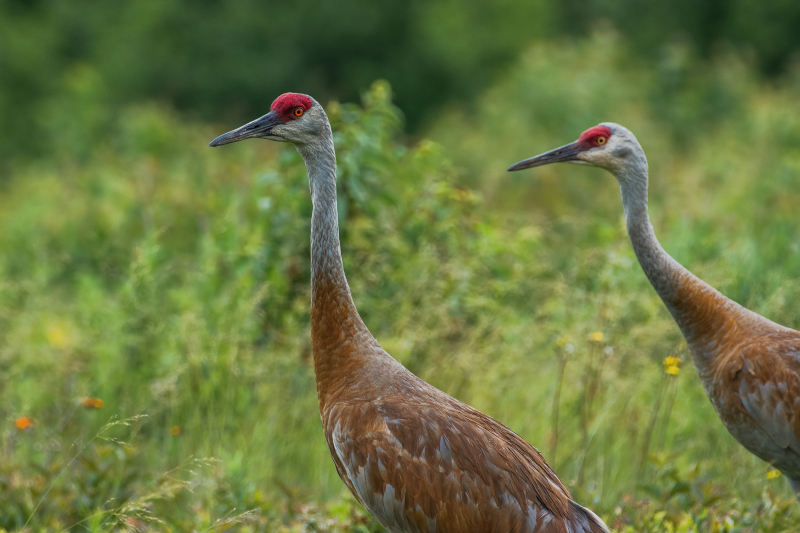
Sandhill Cranes 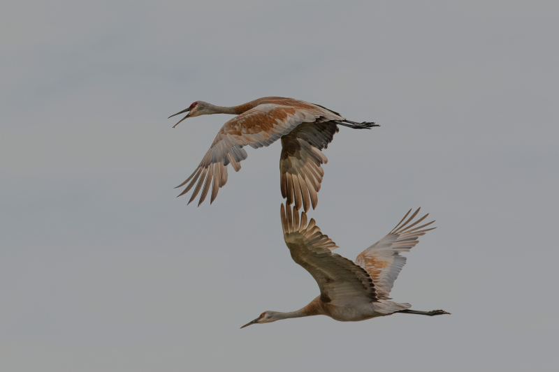
Sandhill Cranes in flight 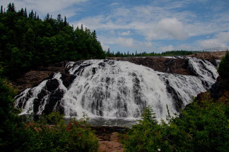
High Falls
We drove to the Government Docks and up to Lake Superior Lookout, pretty lame lookout but it was a spot where one of the Group of Seven did a painting, A.Y. Jackson was the painter. Stopped at Silver Falls on the way out, cute. Walked past the barriers to the shoreline.
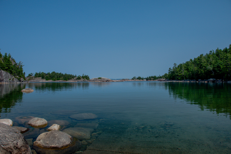
We stopped at the Michipicoten Canoe route. Drove down a dirt road and parked. We walked down the beach, unique spot. This was an important link in the canoe route from Lake Superior to James Bay via three rivers, this being one of the rivers. After 1821 it became known as the Hudson’s Bay Company’s supply line.
Such a great spot 
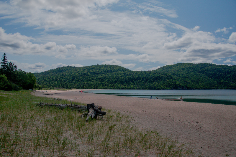
Then to Old Woman Bay and walked the beach.
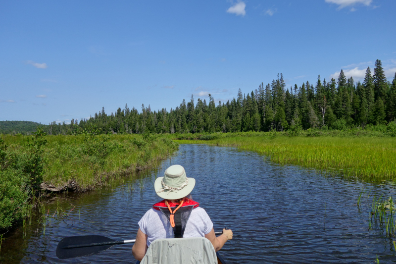
Came home for a bite and then paddled Rabbit Blanket Lake. We went to the far end and paddled the river to the 1st portage. We also went the opposite end of lake and paddled through a tunnel, under the highway to another small marsh.
The end of Rabbit Blanket Lake… 
A portage which is obviously not used 
One of the back country sites on Rabbit Blanket Lake 
Taking a break
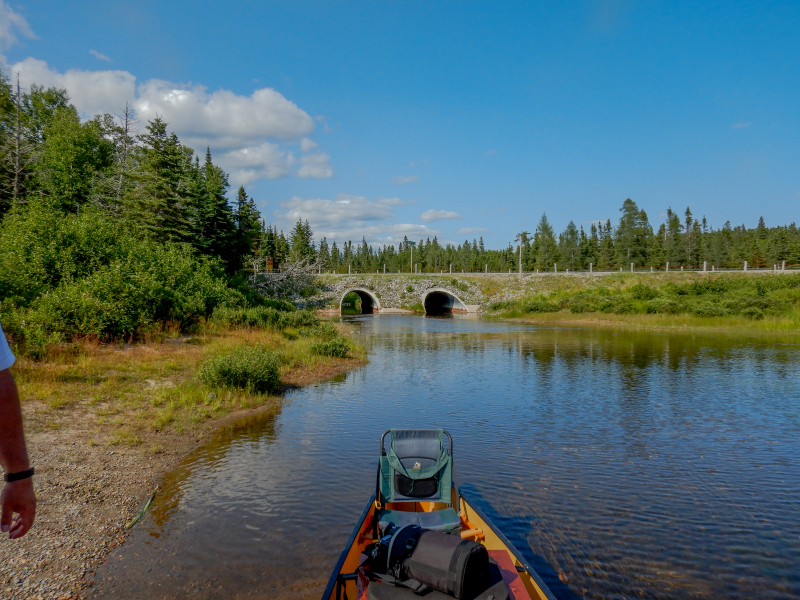
We paddled through the tunnel under the highway to the other side, just a small marsh was there 
We picked a sunny day, 23 Celsius to drive to Gargantua and it was a 14 kms and 35 minute drive (off the highway) down a pretty rough road! We parked and walked the trail to Rocky Harbour which was 6.77 km return, we were gone about 2 1/2 hours as we stopped at lot. It was a really nice walk and we didn’t see anyone until the way back when we were near the entrance. You basically walk around the perimeter of Gargantua Harbour and get to the other side and then come back. About 2/3 of the way around there is a trail to the right and you can access Warp Bay, Chalfant Cove and Indian Harbour. We have never walked down that way. Last time we were here, there was an old rusted saw stuck in a tree but it’s gone now, actually so is the tree! There is also an old Ranger Cabin and it is really dilapidated. The marsh at the top end of the cove was dry, last time we were here there was quite a lot of water.
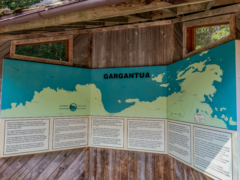
Map of the shoreline in this area 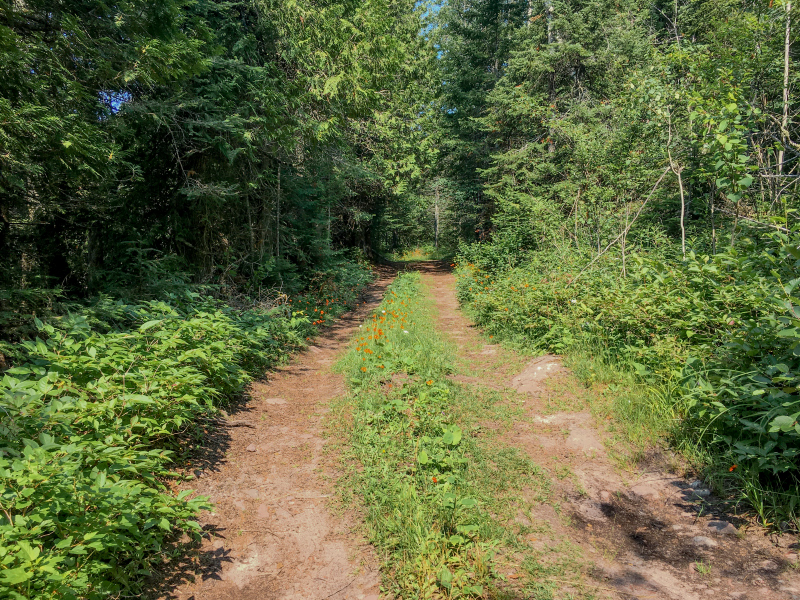
Trail to Gargantua Harbour 
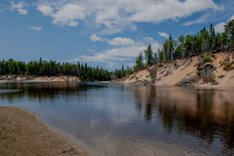
They have beautiful beaches everywhere in Lake Superior area 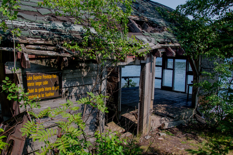
Abandoned Ranger’s Cabin 
It’s unclear why this washroom was out in the middle of nowhere!
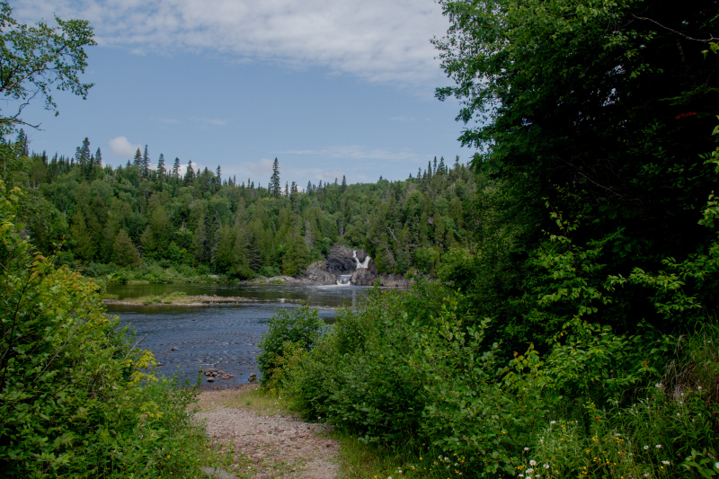
Below is a photo of the Sand River, a place we have been to before and really enjoy. In Ojibwa, it’s called the Pinguisibi which means river of fine, white sand. The trail follows along a series of rapids and waterfalls, it’s a lovely walk.

Sand River
We stopped at Katherine’s Cove just off the highway and walked down to the shoreline. It’s such a beautiful area.

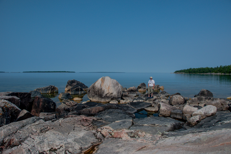
Clint on the rocks 
Me on the Rocks !
We tried Sinclair’s Cove again and we were able to get a spot so we parked and walked the shoreline. Nice spot.
Went to Agawa Pictographs. Walked the trail, rough and steep, you had to be very careful hiking along here, lots of rocks to climb over. When we got to the shoreline, Clint went on to view the Pictographs, I did not. Tiring trail, lots of people. Last time we were here a Park Ranger told us people have died going on the ledge to look at the pictographs. Lake Superior is very unpredictable and the waves can wash people right off the ledge.

This trail was something else, you had to be very careful 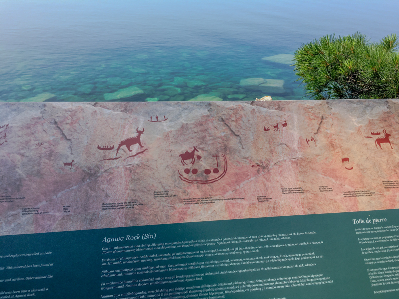
They have a picture board of the pictographs up where I was, no need to go on the ledge! 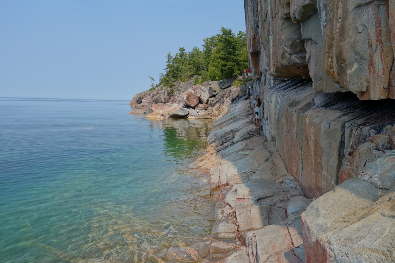
The ledge 
I did not do this part, I stayed up top 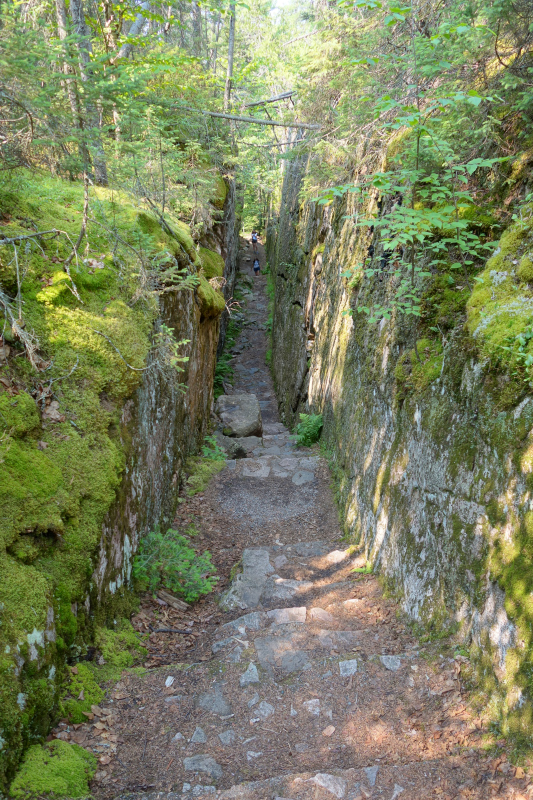
Part of the trail
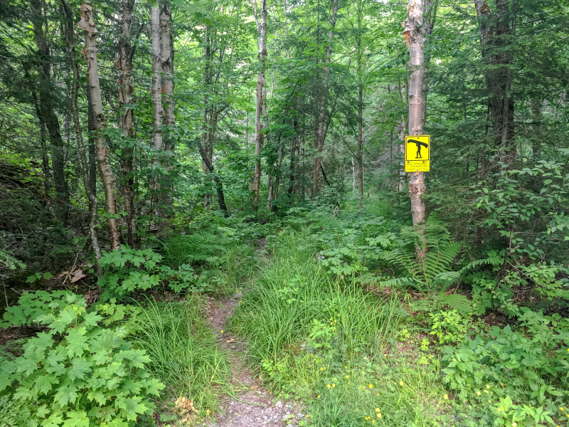
There is a nice trail across the highway from our campground called the Old Woman Trail, it’s 2.5 kms and described as an Easy trail. It was not lol, I literally crawled on my hands and knees to get over the rocks crossing a river, they were huge. My legs are not as long as Clint’s and I don’t have good balance, he leapt over them fairly easily but not me! It was not an easy trail, it wasn’t the hardest I have ever been on but it was not easy. However, it was an interesting trail and I would do it again. This was our second time walking this one as we had done it before when we were here years ago.

Looks like such a nice little trail from the Trailhead but then….. 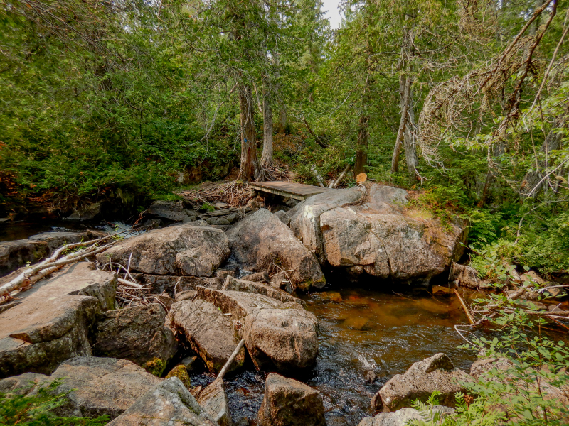
You can see the wooden bridge but to get to it, you have to get over these rocks in the foreground 
Lots of roots and rocks on this trail 
An interesting and sometimes scenic trail
Well that was it for Rabbit Blanket Campground, we stayed here 4 nights and then headed out, more to see!

Great photos, beautiful scenery!
LikeLiked by 1 person
Yes it’s quite a stunning area! Thanks John
LikeLike
I feel like I took a mini-vacation. Wonderful post! The little bunny is too cute and I really enjoyed your many photo shares and learning about the parks you visited. Spending time in nature is so restorative. Thank you for sharing and Happy Holidays!
LikeLiked by 1 person
Thanks Michele! and Happy Holidays to you as well !
LikeLiked by 1 person
Great captures!
LikeLiked by 1 person
Thank you !
LikeLiked by 1 person
Such a great area to see..and beautiful images.
LikeLiked by 1 person
It is a favourite area of mine 🙂
LikeLike
Sound and looks great
LikeLiked by 1 person
I would love to go there in the winter! I think it could be spectacular but it’s such a long drive from us.
LikeLike
Yes, winter gives a different experience,
LikeLiked by 1 person
thank you !
LikeLike
Wow ! another incredible journey 🙂 your country is so wonderful !
LikeLiked by 1 person
Ah thank you! I feel the same about Canada. I never get tired of traveling in my own country although I do hope to travel more in other countries when this Apocalypse slows down lol
LikeLike
Beautiful – I wish I still lived in my homeland. Those are some rigorous trails for hiking and I don’t blame you for staying up top some of the time and how nice you didn’t need to go on that dangerous ledge and could view the pictographs that way.
LikeLiked by 1 person
Yes my husband is more adventurous than I lol. I can be a bit of a chicken sometimes 😊
LikeLiked by 1 person
I don’t blame you on the roots trail – yikes!
LikeLiked by 1 person
I know right? I’m mostly looking down when I’m walking lol
LikeLiked by 1 person
I so enjoy your pictures, I’m not sure I would want to leave!
LikeLiked by 1 person
I can’t wait to go camping/traveling again😊
LikeLike